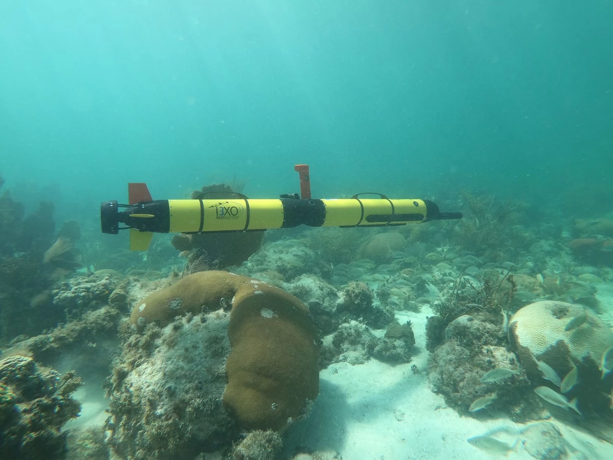
brochure du produit i3XO ecomapper AUV
brochure du produit i3XO ecomapper AUV pour la cartographie de qualité de l'eau, courants et bathymétrie
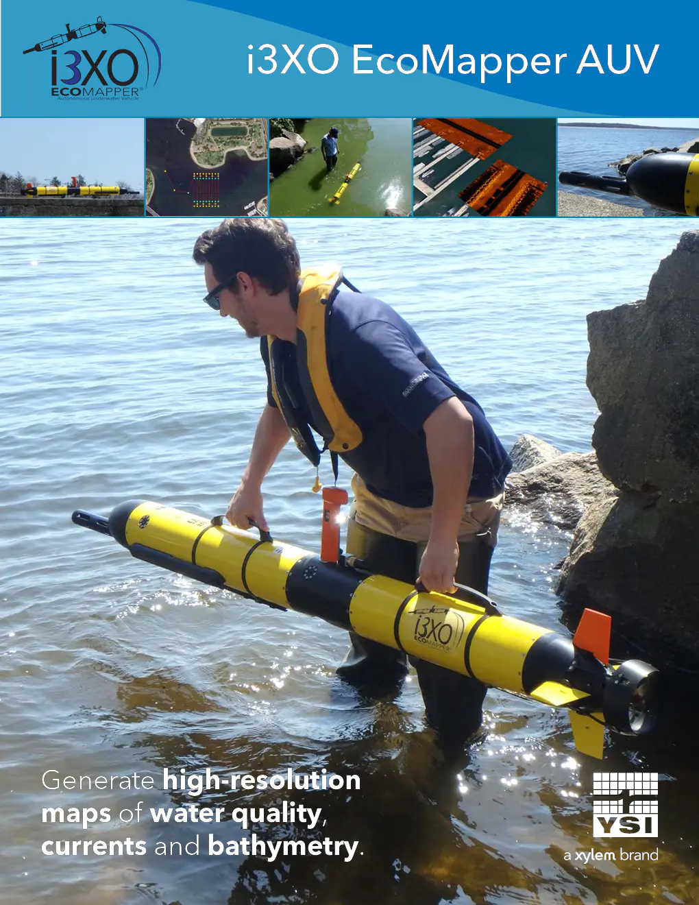
Contenu du document
i3XO EcoMapper AUV
Générer des cartes haute résolution de la qualité de l'eau, des courants et de la bathymétrie.
i3XO EcoMapper AUV
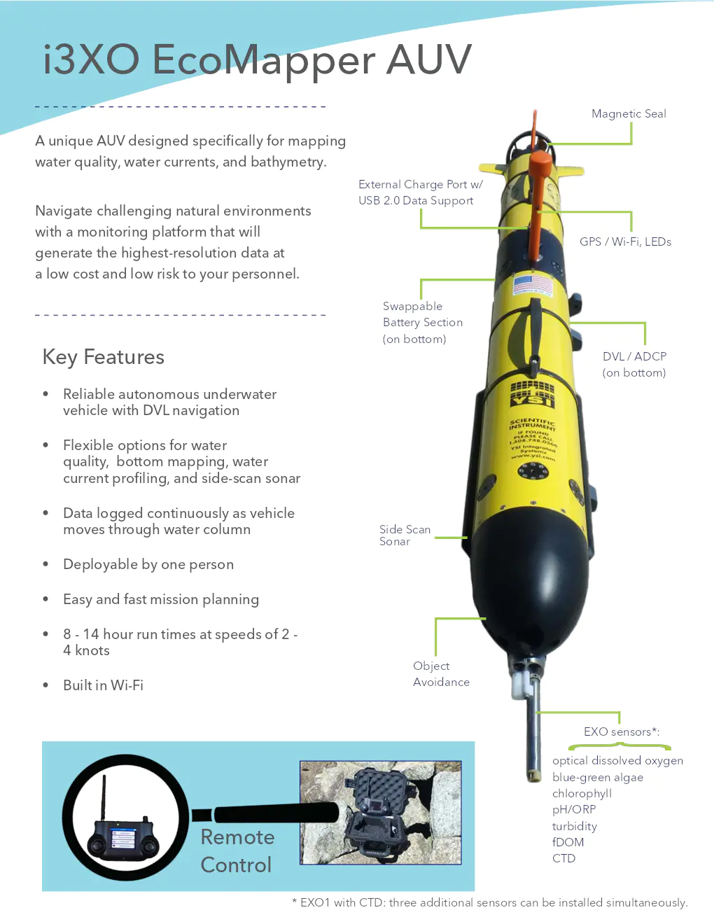
Magnetic Seal
Un AUV unique conçu spécifiquement pour cartographier la qualité de l'eau, les courants d'eau et la bathymétrie.
Naviguer dans des environnements naturels difficiles avec une plateforme de surveillance qui générera les données de la plus haute résolution à un faible coût et un faible risque pour votre personnel.
Caractéristiques principales
- Véhicule autonome sous-marin fiable avec navigation DVL
- Options flexibles pour la qualité de l'eau, la cartographie du fond, le profilage des courants d'eau et le sonar à balayage latéral
- Les données sont enregistrées en continu pendant que le véhicule se déplace dans la colonne d'eau
- Déployable par une seule personne
- Planification de mission facile et rapide
- Temps de fonctionnement de 8 à 14 heures à des vitesses de 2 à 4 nœuds
- Évitement d'objets intégré
EXO sensors:
- Oxygène dissous optique
- Algues bleu-vert
- Chlorophylle
- pH/ORP
- Turbidité
- fDOM
- CTD
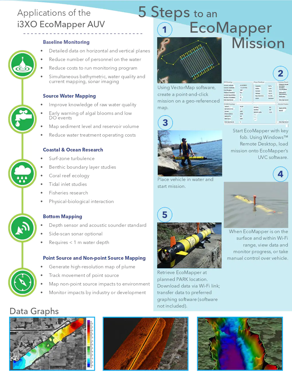
Applications de l'i3XO EcoMapper AUV
- Surveillance de base: Données détaillées sur les plans horizontaux et verticaux, réduire le nombre de personnes sur l'eau, réduire les coûts du programme de surveillance, cartographie simultanée bathymétrique, de la qualité de l'eau et des courants, imagerie sonar
- Cartographie de l'eau source: Améliorer la connaissance de la qualité de l'eau brute, avertissement précoce des proliférations d'algues et des événements de faible DO, cartographier le niveau des sédiments et le volume du réservoir, réduire les coûts d'exploitation du traitement de l'eau
- Recherche côtière et océanique: Turbulence en zone de surf, études de la couche limite benthique, écologie des récifs coralliens, études des entrées de marée, recherche sur les pêcheries, interaction physique-biologique
- Cartographie du fond: Capteur de profondeur et sondeur acoustique standard, sonar à balayage latéral en option, nécessite moins de 1 m de profondeur d'eau
- Cartographie des sources ponctuelles et non ponctuelles: Générer une carte haute résolution du panache, suivre le mouvement de la source ponctuelle, cartographier les impacts des sources non ponctuelles sur l'environnement, surveiller les impacts par l'industrie ou le développement
Spécifications de l'i3XO EcoMapper AUV
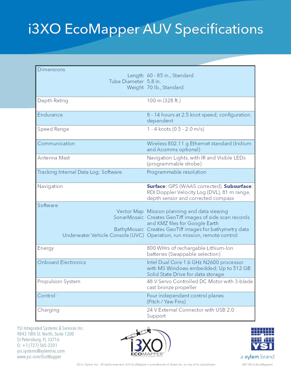
- Dimensions: Longueur de 60 à 85 pouces, diamètre du tube standard de 5,8 pouces, poids standard de 70 lb
- Profondeur nominale: 100 m (328 ft)
- Autonomie: 8 à 14 heures à une vitesse de 2,5 nœuds; configuration dépendante
- Plage de vitesse: 1 à 4 nœuds (0,5 à 2,0 m/s)
- Communication: Ethernet sans fil 802.11 g standard (Iridium et Acomms en option)
- Mât d'antenne: Feux de navigation avec IR et LED visibles (stroboscope programmable)
- Suivi: Journal interne des données; résolution programmable par logiciel
- Navigation: Surface: GPS (corrected WAAS). Subsurface: RDI Doppler Velocity Log (DVL), portée de 81 m, capteur de profondeur et compas corrigé
- Logiciel: Vector Map pour la planification de mission et la visualisation des données, SonarMosaic crée des images GeoTiff des enregistrements de balayage latéral et des fichiers KMZ pour Google Earth, BathyMosaic crée des images GeoTiff pour les données bathymétriques, Console du véhicule sous-marin (UVC) pour l'exploitation, exécution de mission, contrôle à distance
- Énergie: 800 WHrs de batteries Lithium-Ion rechargeables (sélection interchangeable)
- Électronique embarquée: Processeur Intel Dual Core 1.6 GHz N2600 avec Windows MS intégré; jusqu'à 512 Go de disque SSD pour le stockage de données
- Système de propulsion: Moteur DC contrôlé par servo 48 V avec hélice en bronze à 3 pales
- Chargement: Connecteur externe 24 V avec support USB 2.0
YSI Integrated Systems & Services Inc.
9843 18th St. North, Suite 1200
St Petersburg, FL 33716
O: +1 (727) 565-2201
ysi.systems@xyleminc.com
www.ysi.com/EcoMapper
2016 Xylem, Inc. Tous droits réservés. AUV EcoMapper est une marque déposée de Xylem Inc. ou de l'une de ses filiales. E87-0816 (EcoMapper)
